


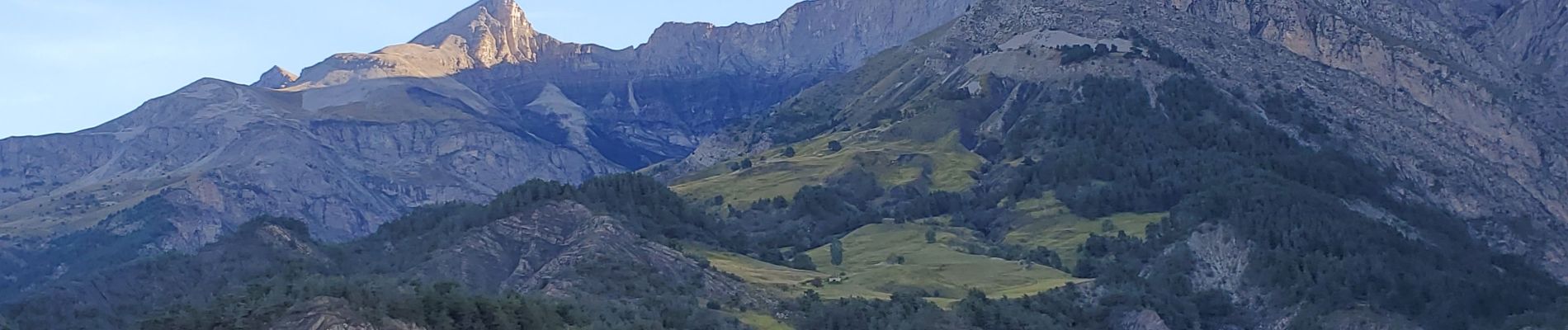
Prads-Haute-Bléone bois de la julie 800m 16kms

Danielba
User GUIDE
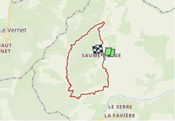

Length
15.2 km

Max alt
1726 m

Uphill gradient
799 m
Km-Effort
26 km

Min alt
1204 m

Downhill gradient
782 m
Boucle
Yes
Creation date :
2024-09-24 06:27:06.956
Updated on :
2024-09-24 17:57:13.966
7h53
Difficulty : Medium

FREE GPS app for hiking
 SityTrail
IGN / Geographical institutes
SityTrail Plus
The world is yours!
About
Trail Walking of 15.2 km to be discovered at Provence-Alpes-Côte d'Azur, Alpes-de-Haute-Provence, Prads-Haute-Bléone. This trail is proposed by Danielba .
Photos

Positioning
Country:
France
Region :
Provence-Alpes-Côte d'Azur
Department/Province :
Alpes-de-Haute-Provence
Municipality :
Prads-Haute-Bléone
Location:
Prads
Start:(Dec)
Start:(UTM)
296903 ; 4903723 (32T) N.
Comments