


sicie 5

soca
User

Length
5.3 km

Max alt
339 m

Uphill gradient
233 m
Km-Effort
8.4 km

Min alt
106 m

Downhill gradient
203 m
Boucle
No
Creation date :
2024-09-25 10:04:58.987
Updated on :
2024-09-25 13:01:18.181
2h55
Difficulty : Medium

FREE GPS app for hiking
 SityTrail
IGN / Geographical institutes
SityTrail Plus
The world is yours!
About
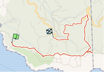
Trail Walking of 5.3 km to be discovered at Provence-Alpes-Côte d'Azur, Var, Six-Fours-les-Plages. This trail is proposed by soca.
Positioning
Country:
France
Region :
Provence-Alpes-Côte d'Azur
Department/Province :
Var
Municipality :
Six-Fours-les-Plages
Location:
Unknown
Start:(Dec)
Start:(UTM)
729927 ; 4770845 (31T) N.
Comments