


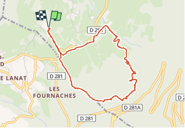
PROMENADE AUTOUR DU COL DES AYES

walrou63
User


3h31
Difficulty : Medium

FREE GPS app for hiking
 SityTrail
IGN / Geographical institutes
SityTrail Plus
The world is yours!
About
Trail Walking of 5.1 km to be discovered at Auvergne-Rhône-Alpes, Isère, Theys. This trail is proposed by walrou63.
Description
Départ depuis le camping des 7 Laux, mais d'anciens chemins ont plus ou moins disparu avec l'exploitation forestière, ce qui a rendu cette sortie un peu Rock and Roll.
Photos


23 photos in total. Please click on a photo to see them all in the gallery.
Positioning
Comments