


Sigoyer ceüse 17.6kms 955m

Danielba
User GUIDE
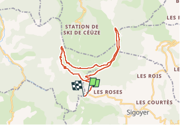

Length
16.9 km

Max alt
2014 m

Uphill gradient
990 m
Km-Effort
30 km

Min alt
1290 m

Downhill gradient
981 m
Boucle
No
Creation date :
2024-09-29 06:49:33.237
Updated on :
2024-09-30 14:03:56.962
6h26
Difficulty : Medium

FREE GPS app for hiking
 SityTrail
IGN / Geographical institutes
SityTrail Plus
The world is yours!
About
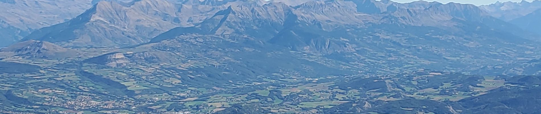
Trail Walking of 16.9 km to be discovered at Provence-Alpes-Côte d'Azur, Hautes-Alpes, Sigoyer. This trail is proposed by Danielba .
Photos


Positioning
Country:
France
Region :
Provence-Alpes-Côte d'Azur
Department/Province :
Hautes-Alpes
Municipality :
Sigoyer
Location:
Unknown
Start:(Dec)
Start:(UTM)
733838 ; 4930124 (31T) N.
Comments