


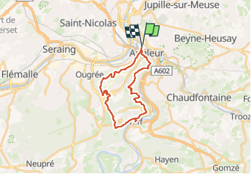
Randonnée Matteo 02/10/24

fabrice.delfosse
User

Length
23 km

Max alt
267 m

Uphill gradient
573 m
Km-Effort
31 km

Min alt
64 m

Downhill gradient
573 m
Boucle
Yes
Creation date :
2024-10-02 11:11:44.315
Updated on :
2024-10-02 17:43:27.842
6h30
Difficulty : Medium

FREE GPS app for hiking
 SityTrail
IGN / Geographical institutes
SityTrail Plus
The world is yours!
About
Trail Walking of 23 km to be discovered at Wallonia, Liège, Liège. This trail is proposed by fabrice.delfosse.
Positioning
Country:
Belgium
Region :
Wallonia
Department/Province :
Liège
Municipality :
Liège
Location:
Angleur
Start:(Dec)
Start:(UTM)
683317 ; 5610467 (31U) N.
Comments