


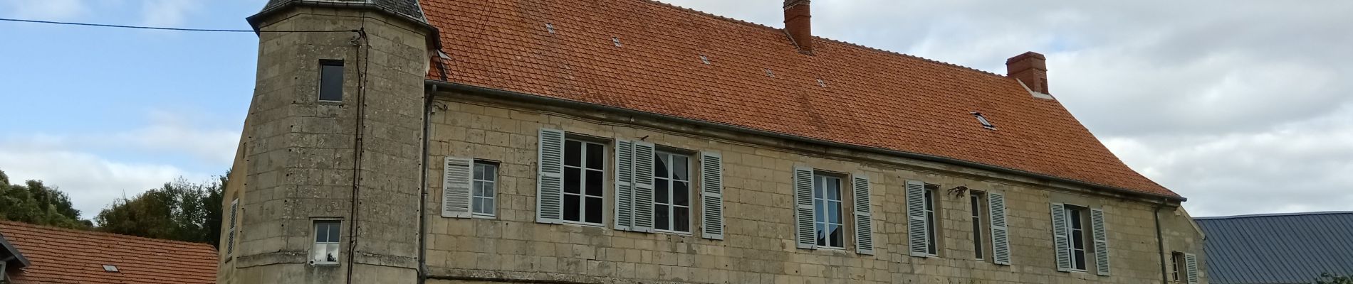
Nanteuil-Notre-Dame du 02-10-2024

VANDERPUTTENMi
User GUIDE
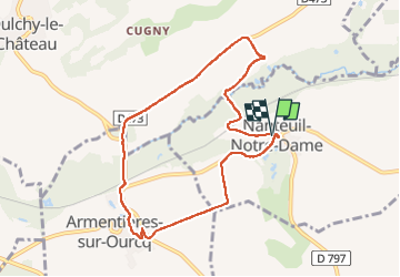

Length
8 km

Max alt
122 m

Uphill gradient
89 m
Km-Effort
9.2 km

Min alt
87 m

Downhill gradient
87 m
Boucle
Yes
Creation date :
2024-10-03 12:13:14.187
Updated on :
2024-10-03 16:22:06.131
2h05
Difficulty : Medium

FREE GPS app for hiking
 SityTrail
IGN / Geographical institutes
SityTrail Plus
The world is yours!
About
Trail Walking of 8 km to be discovered at Hauts-de-France, Aisne, Nanteuil-Notre-Dame. This trail is proposed by VANDERPUTTENMi.
Description
Randonnée facile
Photos


Positioning
Country:
France
Region :
Hauts-de-France
Department/Province :
Aisne
Municipality :
Nanteuil-Notre-Dame
Location:
Unknown
Start:(Dec)
Start:(UTM)
529678 ; 5448889 (31U) N.
Comments