


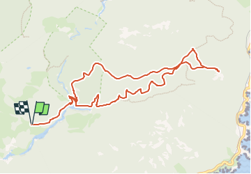
COL DE BELLE BARBE PIC AURELLE RETOUR

clintest
User

Length
11.8 km

Max alt
295 m

Uphill gradient
350 m
Km-Effort
16.5 km

Min alt
27 m

Downhill gradient
350 m
Boucle
Yes
Creation date :
2024-10-04 08:08:22.577
Updated on :
2024-10-04 08:09:34.62
3h44
Difficulty : Easy

FREE GPS app for hiking
 SityTrail
IGN / Geographical institutes
SityTrail Plus
The world is yours!
About
Trail On foot of 11.8 km to be discovered at Provence-Alpes-Côte d'Azur, Var, Saint-Raphaël. This trail is proposed by clintest.
Description
montee par le ravin mal infernet - col des lentisques - pic aurelle
Positioning
Country:
France
Region :
Provence-Alpes-Côte d'Azur
Department/Province :
Var
Municipality :
Saint-Raphaël
Location:
Unknown
Start:(Dec)
Start:(UTM)
327601 ; 4813739 (32T) N.
Comments