


pinconniere

gerardh
User
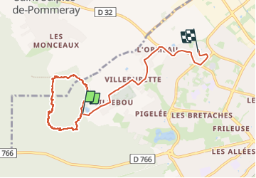

Length
8.2 km

Max alt
142 m

Uphill gradient
55 m
Km-Effort
9 km

Min alt
111 m

Downhill gradient
67 m
Boucle
No
Creation date :
2024-10-04 12:17:45.96
Updated on :
2024-10-04 15:10:33.427
2h51
Difficulty : Medium

FREE GPS app for hiking
 SityTrail
IGN / Geographical institutes
SityTrail Plus
The world is yours!
About
Trail Walking of 8.2 km to be discovered at Centre-Loire Valley, Loir-et-Cher, Blois. This trail is proposed by gerardh.
Positioning
Country:
France
Region :
Centre-Loire Valley
Department/Province :
Loir-et-Cher
Municipality :
Blois
Location:
Unknown
Start:(Dec)
Start:(UTM)
370474 ; 5272068 (31T) N.
Comments