


Montagne de Saint-Génis (05)

Clo0413
User

Length
16.6 km

Max alt
1240 m

Uphill gradient
711 m
Km-Effort
26 km

Min alt
697 m

Downhill gradient
698 m
Boucle
Yes
Creation date :
2024-10-06 07:09:38.819
Updated on :
2024-10-09 11:26:37.318
4h45
Difficulty : Medium

FREE GPS app for hiking
 SityTrail
IGN / Geographical institutes
SityTrail Plus
The world is yours!
About
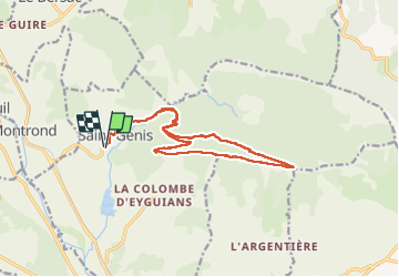
Trail Walking of 16.6 km to be discovered at Provence-Alpes-Côte d'Azur, Hautes-Alpes, Garde-Colombe. This trail is proposed by Clo0413.
Positioning
Country:
France
Region :
Provence-Alpes-Côte d'Azur
Department/Province :
Hautes-Alpes
Municipality :
Garde-Colombe
Location:
Unknown
Start:(Dec)
Start:(UTM)
720486 ; 4917603 (31T) N.
Comments