Trail Horseback riding Obersteinbach - suuntoapp-HorsebackRiding-2024-09-30T07-27-07Z - Photo

suuntoapp-HorsebackRiding-2024-09-30T07-27-07Z

 holtzv
holtzv

User GUIDE

© OpenStreetMap contributors
Length
Length
29 km
Max alt
Max alt
473 m
Uphill gradient
Uphill gradient
930 m
Km-Effort
Km-Effort  
42 km
Min alt
Min alt
216 m
Downhill gradient
Downhill gradient
931 m
Boucle
Boucle
Yes
Creation date :
2024-10-07 12:55:31.674
Updated on :
2024-10-07 13:51:00.737

(1 Reviews)

Horseback riding
Horseback riding
5h30
Difficulty : Very difficult

Scan this QR Code to open this trail in the SityTrail application

FREE GPS app for hiking

Logo SityTrail SityTrail

IGN / Geographical institutes

Download SityTrail from the App Store Download SityTrail from Google Play

Logo SityTrail SityTrail Plus

The world is yours!

Download SityTrail from the App Store Download SityTrail from Google Play Download SityTrail on Huawei AppGallery

About

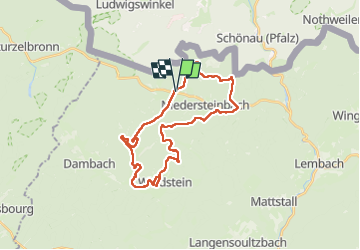
Trail Horseback riding of 29 km to be discovered at Grand Est, Bas-Rhin, Obersteinbach. This trail is proposed by holtzv.

Description

Rando CVA Palatinat : Jour 4 sur 6

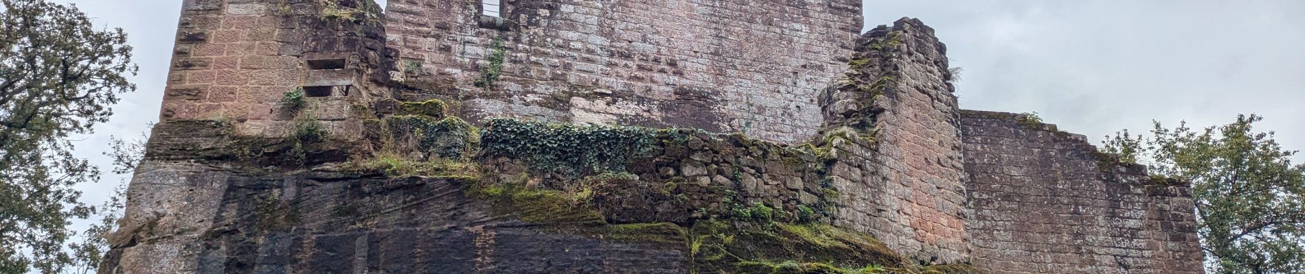
Journée à cheval en boucle autour d’Obersteinbach en passant par le château du Wineck, le nouveau et l’ancien Windstein, descente vers Niedersteinbach pour remonter de l’autre côté vers le château du Wasigenstein.

N.B. : Passage par la forêt privée De Dietrich nécessitant un droit de passage à 2,5€/cavalier/jour à payer au Groupement Forestier des Vosges Nord (privé).

Elevation profile

Photos

Positioning

Country:
France
Region :
Grand Est
Department/Province :
Bas-Rhin
Municipality :
Obersteinbach
Location:
Unknown
Start:(UTM)
404381 ; 5432313 (32U) N.

Comments

Please log in to post a review or rate the element


Close
My subscriptions