Trail Horseback riding Obersteinbach - suuntoapp-HorsebackRiding-2024-10-01T07-38-54Z - Photo

suuntoapp-HorsebackRiding-2024-10-01T07-38-54Z

 holtzv
holtzv

User GUIDE

© OpenStreetMap contributors
Length
Length
30 km
Max alt
Max alt
499 m
Uphill gradient
Uphill gradient
743 m
Km-Effort
Km-Effort  
40 km
Min alt
Min alt
179 m
Downhill gradient
Downhill gradient
772 m
Boucle
Boucle
No
Creation date :
2024-10-07 13:04:43.786
Updated on :
2024-10-07 13:20:32.922

(0 Reviews)

Horseback riding
Horseback riding
5h16
Difficulty : Difficult

Scan this QR Code to open this trail in the SityTrail application

FREE GPS app for hiking

Logo SityTrail SityTrail

IGN / Geographical institutes

Download SityTrail from the App Store Download SityTrail from Google Play

Logo SityTrail SityTrail Plus

The world is yours!

Download SityTrail from the App Store Download SityTrail from Google Play Download SityTrail on Huawei AppGallery

About

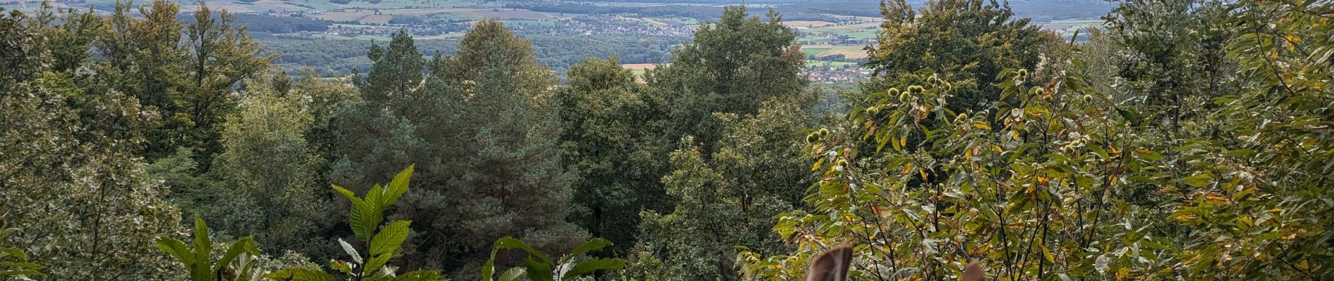
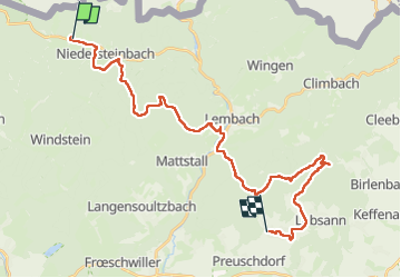
Trail Horseback riding of 30 km to be discovered at Grand Est, Bas-Rhin, Obersteinbach. This trail is proposed by holtzv.

Description

Rando CVA Palatinat : Jour 5 sur 6

Journée à cheval d’Obersteinbach vers Lampertsloch en passant par la forêt de La Verrerie, une autre forêt privée où il faut demander le droit de passage au Comte Jérôme de Pourtales. Pause repas aux écuries du Flecken avant de repartir par le Soultzerkopf et sa belle vue et l’auberge des 7 fontaines pour une pause 16h.

Elevation profile

Photos

Positioning

Country:
France
Region :
Grand Est
Department/Province :
Bas-Rhin
Municipality :
Obersteinbach
Location:
Unknown
Start:(UTM)
404387 ; 5432306 (32U) N.


Close
My subscriptions