


sentier Pagnol

jcm17
User
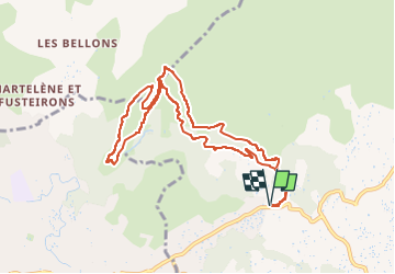

Length
10.4 km

Max alt
371 m

Uphill gradient
336 m
Km-Effort
14.8 km

Min alt
198 m

Downhill gradient
335 m
Boucle
Yes
Creation date :
2024-10-04 08:01:53.99
Updated on :
2024-10-09 11:31:54.809
7h24
Difficulty : Difficult

FREE GPS app for hiking
 SityTrail
IGN / Geographical institutes
SityTrail Plus
The world is yours!
About
Trail Walking of 10.4 km to be discovered at Provence-Alpes-Côte d'Azur, Bouches-du-Rhône, Aubagne. This trail is proposed by jcm17.
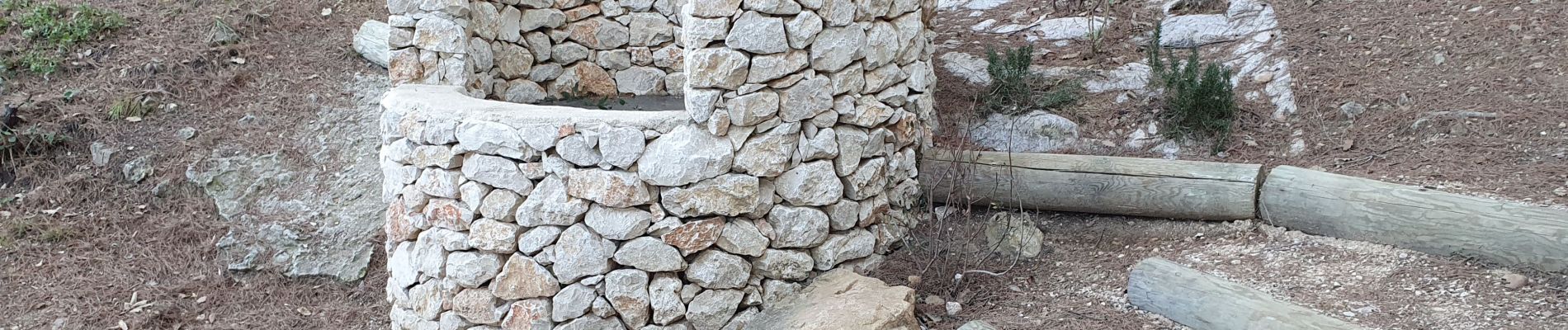
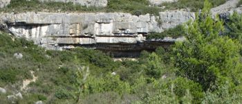
Photos

Positioning
Country:
France
Region :
Provence-Alpes-Côte d'Azur
Department/Province :
Bouches-du-Rhône
Municipality :
Aubagne
Location:
Unknown
Start:(Dec)
Start:(UTM)
706383 ; 4798281 (31T) N.
Comments