


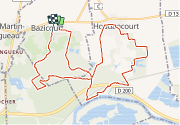
bazicourt

pascha
User

Length
13 km

Max alt
55 m

Uphill gradient
94 m
Km-Effort
14.3 km

Min alt
27 m

Downhill gradient
94 m
Boucle
No
Creation date :
2015-05-17 00:00:00.0
Updated on :
2015-05-17 00:00:00.0
3h12
Difficulty : Unknown

FREE GPS app for hiking
 SityTrail
IGN / Geographical institutes
SityTrail Plus
The world is yours!
About
Trail Walking of 13 km to be discovered at Hauts-de-France, Oise, Bazicourt. This trail is proposed by pascha.
Positioning
Country:
France
Region :
Hauts-de-France
Department/Province :
Oise
Municipality :
Bazicourt
Location:
Unknown
Start:(Dec)
Start:(UTM)
472361 ; 5465589 (31U) N.
Comments