


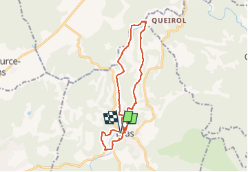
Chute du Tombereau, Bras 11-10-2024

Christiancordin
User

Length
14.7 km

Max alt
329 m

Uphill gradient
263 m
Km-Effort
18.2 km

Min alt
249 m

Downhill gradient
264 m
Boucle
Yes
Creation date :
2024-10-11 16:15:42.805
Updated on :
2024-10-11 16:22:15.933
4h08
Difficulty : Easy

FREE GPS app for hiking
 SityTrail
IGN / Geographical institutes
SityTrail Plus
The world is yours!
About
Trail On foot of 14.7 km to be discovered at Provence-Alpes-Côte d'Azur, Var, Bras. This trail is proposed by Christiancordin.
Description
Départ Pk du stade près du lavoir, les gouffres bénits, chapelle des templiers, chapelle st Pierre, le Cauron, la chute du Tombereau, l'Argens, pont de la Cadette, pont de St Sumian, Bras.
Photos


Positioning
Country:
France
Region :
Provence-Alpes-Côte d'Azur
Department/Province :
Var
Municipality :
Bras
Location:
Unknown
Start:(Dec)
Start:(UTM)
738717 ; 4817477 (31T) N.
Comments