


TRK000

Rando MLC
User
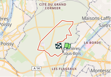

Length
10.5 km

Max alt
83 m

Uphill gradient
98 m
Km-Effort
11.8 km

Min alt
62 m

Downhill gradient
98 m
Boucle
Yes
Creation date :
2024-10-12 08:49:00.601
Updated on :
2024-10-12 08:50:46.187
2h40
Difficulty : Medium

FREE GPS app for hiking
 SityTrail
IGN / Geographical institutes
SityTrail Plus
The world is yours!
About
Trail Walking of 10.5 km to be discovered at Ile-de-France, Yvelines, Saint-Germain-en-Laye. This trail is proposed by Rando MLC.
Positioning
Country:
France
Region :
Ile-de-France
Department/Province :
Yvelines
Municipality :
Saint-Germain-en-Laye
Location:
Saint-Germain-en-Laye
Start:(Dec)
Start:(UTM)
434498 ; 5419041 (31U) N.
Comments