


20241012 Chamonix Les Nants

Childebert
User
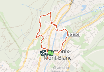

Length
4 km

Max alt
1196 m

Uphill gradient
164 m
Km-Effort
6.2 km

Min alt
1034 m

Downhill gradient
165 m
Boucle
Yes
Creation date :
2024-10-12 11:22:41.302
Updated on :
2024-10-12 13:40:38.266
2h17
Difficulty : Difficult

FREE GPS app for hiking
 SityTrail
IGN / Geographical institutes
SityTrail Plus
The world is yours!
About
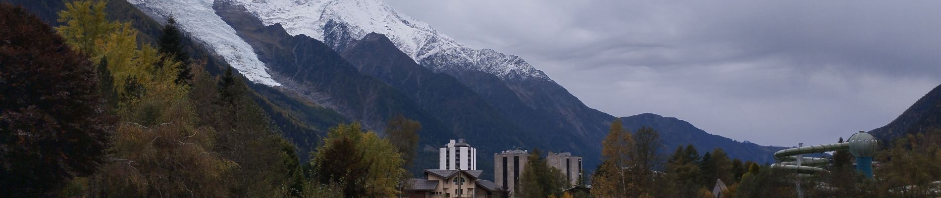
Trail Walking of 4 km to be discovered at Auvergne-Rhône-Alpes, Upper Savoy, Chamonix-Mont-Blanc. This trail is proposed by Childebert.
Photos

Positioning
Country:
France
Region :
Auvergne-Rhône-Alpes
Department/Province :
Upper Savoy
Municipality :
Chamonix-Mont-Blanc
Location:
Unknown
Start:(Dec)
Start:(UTM)
334810 ; 5087766 (32T) N.
Comments