


Forêt de Belesta Ariège André

Ada11
User GUIDE

Length
16.5 km

Max alt
939 m

Uphill gradient
654 m
Km-Effort
25 km

Min alt
493 m

Downhill gradient
653 m
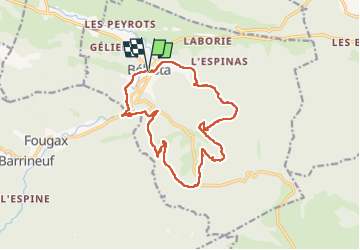
Boucle
Yes
Creation date :
2024-10-13 08:00:23.039
Updated on :
2024-10-13 14:46:31.132
5h56
Difficulty : Medium

FREE GPS app for hiking
 SityTrail
IGN / Geographical institutes
SityTrail Plus
The world is yours!
About
Trail Walking of 16.5 km to be discovered at Occitania, Ariège, Bélesta. This trail is proposed by Ada11.
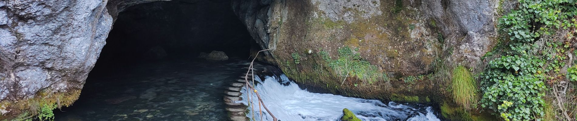
Photos

Positioning
Country:
France
Region :
Occitania
Department/Province :
Ariège
Municipality :
Bélesta
Location:
Unknown
Start:(Dec)
Start:(UTM)
412969 ; 4750548 (31T) N.
Comments