


Malbosquet

Roger Philippe Wallez
User GUIDE
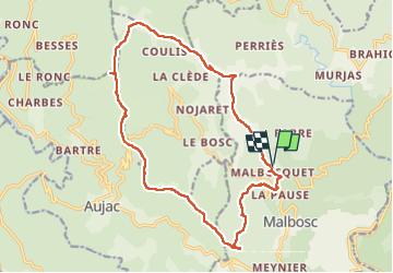

Length
19.2 km

Max alt
958 m

Uphill gradient
914 m
Km-Effort
31 km

Min alt
311 m

Downhill gradient
914 m
Boucle
Yes
Creation date :
2024-10-13 07:48:55.0
Updated on :
2024-10-13 15:52:00.507
7h59
Difficulty : Very difficult

FREE GPS app for hiking
 SityTrail
IGN / Geographical institutes
SityTrail Plus
The world is yours!
About
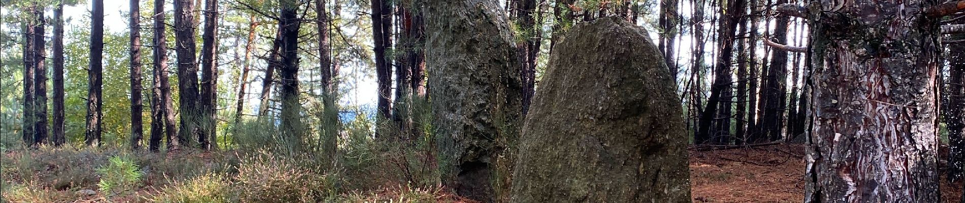
Trail Walking of 19.2 km to be discovered at Auvergne-Rhône-Alpes, Ardèche, Malbosc. This trail is proposed by Roger Philippe Wallez.
Photos


Positioning
Country:
France
Region :
Auvergne-Rhône-Alpes
Department/Province :
Ardèche
Municipality :
Malbosc
Location:
Unknown
Start:(Dec)
Start:(UTM)
585178 ; 4912283 (31T) N.
Comments