


Lac d'Arou et pic de Monfaucon

chasle
User
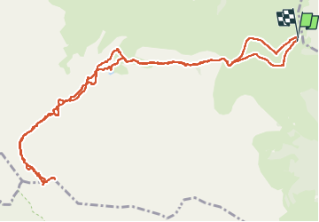

Length
15.6 km

Max alt
2692 m

Uphill gradient
1244 m
Km-Effort
32 km

Min alt
1560 m

Downhill gradient
1249 m
Boucle
Yes
Creation date :
2024-10-15 05:51:16.158
Updated on :
2024-10-17 07:52:42.421
5h01
Difficulty : Difficult

FREE GPS app for hiking
 SityTrail
IGN / Geographical institutes
SityTrail Plus
The world is yours!
About
Trail Walking of 15.6 km to be discovered at Occitania, Hautespyrenees, Ancizan. This trail is proposed by chasle.
Positioning
Country:
France
Region :
Occitania
Department/Province :
Hautespyrenees
Municipality :
Ancizan
Location:
Unknown
Start:(Dec)
Start:(UTM)
280002 ; 4753184 (31T) N.
Comments