


Le Pas de l'Oeuille

andrechauvin
User

Length
14.1 km

Max alt
1959 m

Uphill gradient
856 m
Km-Effort
26 km

Min alt
1238 m

Downhill gradient
855 m
Boucle
Yes
Creation date :
2024-10-15 08:47:36.962
Updated on :
2024-10-15 15:46:56.0
5h09
Difficulty : Difficult

FREE GPS app for hiking
 SityTrail
IGN / Geographical institutes
SityTrail Plus
The world is yours!
About
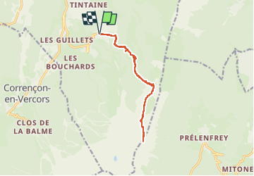
Trail Walking of 14.1 km to be discovered at Auvergne-Rhône-Alpes, Isère, Villard-de-Lans. This trail is proposed by andrechauvin.
Description
rando
Positioning
Country:
France
Region :
Auvergne-Rhône-Alpes
Department/Province :
Isère
Municipality :
Villard-de-Lans
Location:
Unknown
Start:(Dec)
Start:(UTM)
701788 ; 4991961 (31T) N.
Comments