


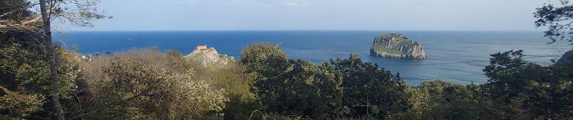
cantabrie J1 gastalugatxe

LouisROGER
User GUIDE
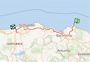

Length
175 km

Max alt
193 m

Uphill gradient
3469 m
Km-Effort
222 km

Min alt
-5 m

Downhill gradient
3576 m
Boucle
No
Creation date :
2024-10-15 10:08:52.372
Updated on :
2024-10-15 18:53:37.728
8h17
Difficulty : Very difficult

FREE GPS app for hiking
 SityTrail
IGN / Geographical institutes
SityTrail Plus
The world is yours!
About
Trail Walking of 175 km to be discovered at Autonomous Community of the Basque Country, Biscay, Bakio. This trail is proposed by LouisROGER.
Photos

Positioning
Country:
Spain
Region :
Autonomous Community of the Basque Country
Department/Province :
Biscay
Municipality :
Bakio
Location:
Unknown
Start:(Dec)
Start:(UTM)
517531 ; 4809794 (30T) N.
Comments