


Saint Haon GR 470

Roger Philippe Wallez
User GUIDE
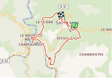

Length
9.4 km

Max alt
1020 m

Uphill gradient
325 m
Km-Effort
13.8 km

Min alt
733 m

Downhill gradient
337 m
Boucle
No
Creation date :
2024-10-16 12:07:30.0
Updated on :
2024-10-16 15:01:28.108
2h43
Difficulty : Difficult

FREE GPS app for hiking
 SityTrail
IGN / Geographical institutes
SityTrail Plus
The world is yours!
About
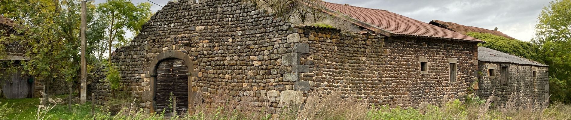
Trail Walking of 9.4 km to be discovered at Auvergne-Rhône-Alpes, Haute-Loire, Saint-Haon. This trail is proposed by Roger Philippe Wallez.
Photos


Positioning
Country:
France
Region :
Auvergne-Rhône-Alpes
Department/Province :
Haute-Loire
Municipality :
Saint-Haon
Location:
Unknown
Start:(Dec)
Start:(UTM)
560030 ; 4965777 (31T) N.
Comments