


Fontvieille - sentier des moulins

mhetpierre
User
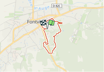

Length
3 km

Max alt
58 m

Uphill gradient
35 m
Km-Effort
3.4 km

Min alt
21 m

Downhill gradient
36 m
Boucle
Yes
Creation date :
2024-10-18 09:28:47.0
Updated on :
2024-10-19 09:49:26.215
46m
Difficulty : Easy

FREE GPS app for hiking
 SityTrail
IGN / Geographical institutes
SityTrail Plus
The world is yours!
About
Trail Walking of 3 km to be discovered at Provence-Alpes-Côte d'Azur, Bouches-du-Rhône, Fontvieille. This trail is proposed by mhetpierre.
Positioning
Country:
France
Region :
Provence-Alpes-Côte d'Azur
Department/Province :
Bouches-du-Rhône
Municipality :
Fontvieille
Location:
Unknown
Start:(Dec)
Start:(UTM)
637768 ; 4842732 (31T) N.
Comments