


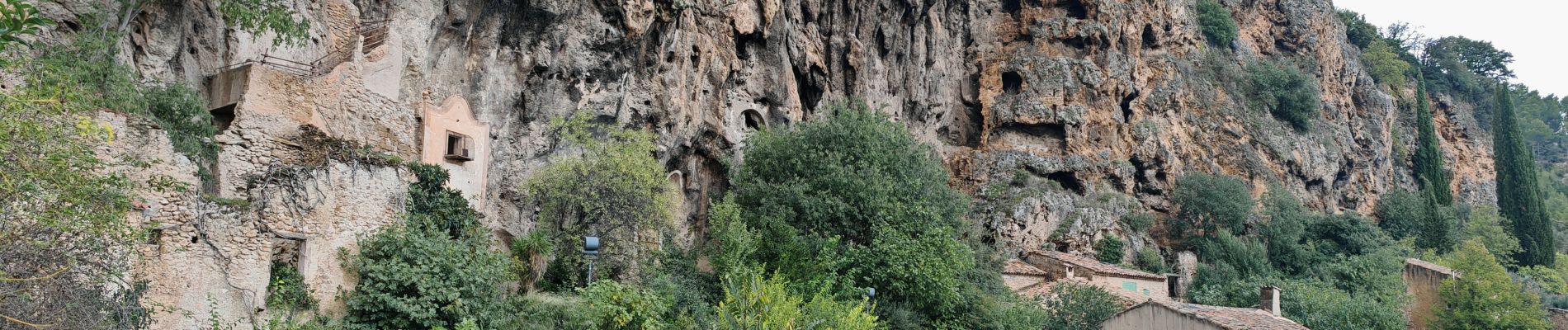
cotignac

bernir
User
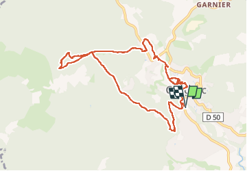

Length
11.1 km

Max alt
452 m

Uphill gradient
289 m
Km-Effort
15 km

Min alt
218 m

Downhill gradient
290 m
Boucle
Yes
Creation date :
2024-10-18 08:03:36.031
Updated on :
2024-10-19 17:33:18.674
6h14
Difficulty : Easy

FREE GPS app for hiking
 SityTrail
IGN / Geographical institutes
SityTrail Plus
The world is yours!
About
Trail Walking of 11.1 km to be discovered at Provence-Alpes-Côte d'Azur, Var, Cotignac. This trail is proposed by bernir.
Photos


Positioning
Country:
France
Region :
Provence-Alpes-Côte d'Azur
Department/Province :
Var
Municipality :
Cotignac
Location:
Unknown
Start:(Dec)
Start:(UTM)
269694 ; 4823030 (32T) N.
Comments