


2015-05-19 Balade Temple du Donon

holtzv
User GUIDE
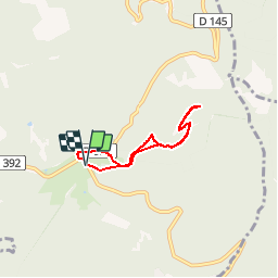

Length
4.6 km

Max alt
996 m

Uphill gradient
276 m
Km-Effort
8.3 km

Min alt
720 m

Downhill gradient
275 m
Boucle
Yes
Creation date :
2015-05-19 00:00:00.0
Updated on :
2015-05-19 00:00:00.0
1h39
Difficulty : Easy

FREE GPS app for hiking
 SityTrail
IGN / Geographical institutes
SityTrail Plus
The world is yours!
About
Trail Walking of 4.6 km to be discovered at Grand Est, Bas-Rhin, Grandfontaine. This trail is proposed by holtzv.
Positioning
Country:
France
Region :
Grand Est
Department/Province :
Bas-Rhin
Municipality :
Grandfontaine
Location:
Unknown
Start:(Dec)
Start:(UTM)
363159 ; 5374263 (32U) N.
Comments
superbe