


Fauveries

Roger Philippe Wallez
User GUIDE
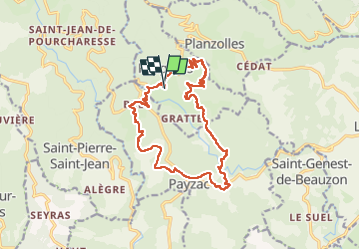

Length
17.6 km

Max alt
481 m

Uphill gradient
529 m
Km-Effort
25 km

Min alt
299 m

Downhill gradient
537 m
Boucle
Yes
Creation date :
2024-10-20 07:39:04.0
Updated on :
2024-10-20 14:45:05.572
7h04
Difficulty : Very difficult

FREE GPS app for hiking
 SityTrail
IGN / Geographical institutes
SityTrail Plus
The world is yours!
About
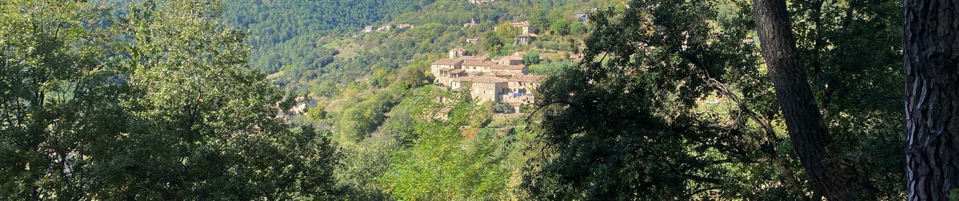
Trail Walking of 17.6 km to be discovered at Auvergne-Rhône-Alpes, Ardèche, Faugères. This trail is proposed by Roger Philippe Wallez.
Photos


Positioning
Country:
France
Region :
Auvergne-Rhône-Alpes
Department/Province :
Ardèche
Municipality :
Faugères
Location:
Unknown
Start:(Dec)
Start:(UTM)
590412 ; 4925215 (31T) N.
Comments