


Colmars autapie 19.5k ms 1200m

Danielba
User GUIDE
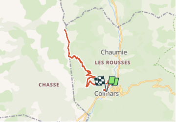

Length
18.8 km

Max alt
2418 m

Uphill gradient
1223 m
Km-Effort
35 km

Min alt
1245 m

Downhill gradient
1222 m
Boucle
Yes
Creation date :
2024-10-20 06:34:01.82
Updated on :
2024-10-20 16:52:48.494
7h43
Difficulty : Medium

FREE GPS app for hiking
 SityTrail
IGN / Geographical institutes
SityTrail Plus
The world is yours!
About
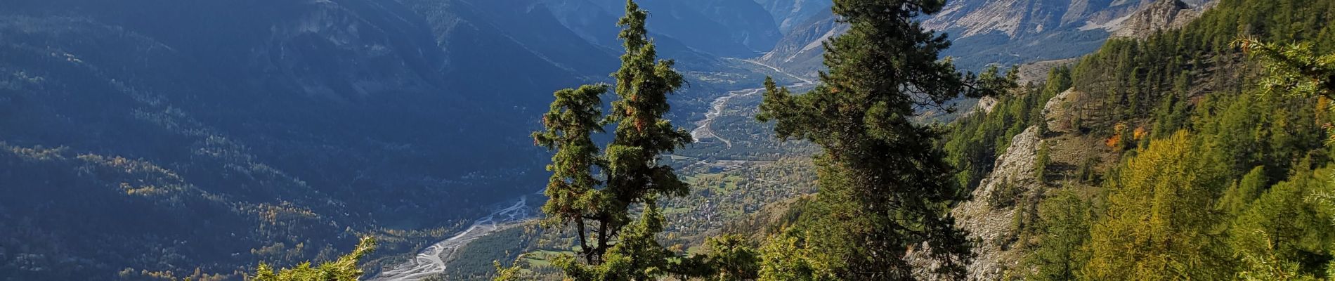
Trail Walking of 18.8 km to be discovered at Provence-Alpes-Côte d'Azur, Alpes-de-Haute-Provence, Colmars. This trail is proposed by Danielba .
Photos


Positioning
Country:
France
Region :
Provence-Alpes-Côte d'Azur
Department/Province :
Alpes-de-Haute-Provence
Municipality :
Colmars
Location:
Unknown
Start:(Dec)
Start:(UTM)
310352 ; 4894868 (32T) N.
Comments