


Demandolx Le Cremon

Clo0413
User
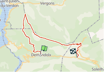

Length
15.9 km

Max alt
1753 m

Uphill gradient
771 m
Km-Effort
26 km

Min alt
1173 m

Downhill gradient
609 m
Boucle
No
Creation date :
2024-10-21 07:03:39.826
Updated on :
2024-10-21 13:53:09.881
4h55
Difficulty : Very difficult

FREE GPS app for hiking
 SityTrail
IGN / Geographical institutes
SityTrail Plus
The world is yours!
About
Trail Walking of 15.9 km to be discovered at Provence-Alpes-Côte d'Azur, Alpes-de-Haute-Provence, Demandolx. This trail is proposed by Clo0413.
Description
randonnée Le Cremon
Positioning
Country:
France
Region :
Provence-Alpes-Côte d'Azur
Department/Province :
Alpes-de-Haute-Provence
Municipality :
Demandolx
Location:
Unknown
Start:(Dec)
Start:(UTM)
305481 ; 4860250 (32T) N.
Comments