


SityTrail - pene arroyo et marianette

chasle
User
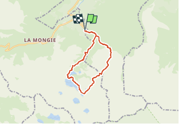

Length
13.3 km

Max alt
2400 m

Uphill gradient
1116 m
Km-Effort
28 km

Min alt
1419 m

Downhill gradient
1117 m
Boucle
Yes
Creation date :
2024-10-23 15:47:11.876
Updated on :
2024-10-23 15:50:38.165
6h24
Difficulty : Difficult

FREE GPS app for hiking
 SityTrail
IGN / Geographical institutes
SityTrail Plus
The world is yours!
About
Trail Walking of 13.3 km to be discovered at Occitania, Hautespyrenees, Bagnères-de-Bigorre. This trail is proposed by chasle.
Description
rando très très difficile dans son ensemble sauf le retour par le gr10.
Positioning
Country:
France
Region :
Occitania
Department/Province :
Hautespyrenees
Municipality :
Bagnères-de-Bigorre
Location:
Unknown
Start:(Dec)
Start:(UTM)
272206 ; 4755392 (31T) N.
Comments