


VILLARS SAINT GEORGES FOURG

micbesac
User

Length
10.8 km

Max alt
306 m

Uphill gradient
164 m
Km-Effort
13 km

Min alt
251 m

Downhill gradient
164 m
Boucle
Yes
Creation date :
2024-10-24 12:38:51.098
Updated on :
2024-10-24 12:44:12.925
2h56
Difficulty : Difficult

FREE GPS app for hiking
 SityTrail
IGN / Geographical institutes
SityTrail Plus
The world is yours!
About
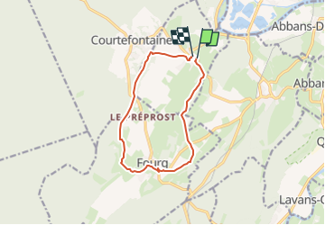
Trail Walking of 10.8 km to be discovered at Bourgogne-Franche-Comté, Doubs, Villars-Saint-Georges. This trail is proposed by micbesac.
Description
Départ parking gite et église Villars Saint Georges direction Fourge par le GR 59 et retour depuis Fourg sur Villars saint Georges
Positioning
Country:
France
Region :
Bourgogne-Franche-Comté
Department/Province :
Doubs
Municipality :
Villars-Saint-Georges
Location:
Unknown
Start:(Dec)
Start:(UTM)
714557 ; 5223015 (31T) N.
Comments