


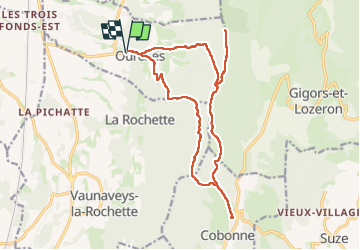
La Draye Ourches Cobonne retour

bymarc26
User

Length
19 km

Max alt
990 m

Uphill gradient
945 m
Km-Effort
32 km

Min alt
335 m

Downhill gradient
946 m
Boucle
Yes
Creation date :
2024-10-24 06:34:31.99
Updated on :
2024-10-24 13:36:21.46
5h15
Difficulty : Medium

FREE GPS app for hiking
 SityTrail
IGN / Geographical institutes
SityTrail Plus
The world is yours!
About
Trail Walking of 19 km to be discovered at Auvergne-Rhône-Alpes, Drôme, Ourches. This trail is proposed by bymarc26.
Photos


Positioning
Country:
France
Region :
Auvergne-Rhône-Alpes
Department/Province :
Drôme
Municipality :
Ourches
Location:
Unknown
Start:(Dec)
Start:(UTM)
661430 ; 4963285 (31T) N.
Comments