


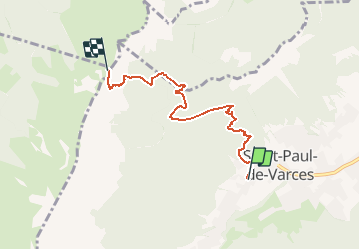

6.5 km | 13.2 km-effort


User


FREE GPS app for hiking
 SityTrail
IGN / Geographical institutes
SityTrail World
The world is yours!
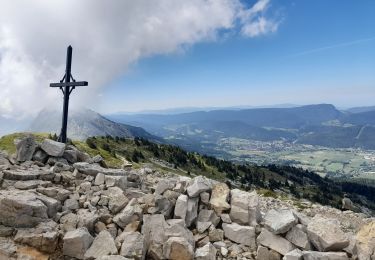
Trail Walking of 5.1 km to be discovered at Auvergne-Rhône-Alpes, Isère, Saint-Paul-de-Varces. This trail is proposed by orpins.
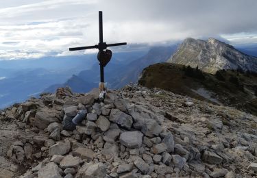
autonomie total
petite forme physique
terrain rendu très gras par les fortes pluies
temps pauses incluses
temps totale 5h30
descente 2h30

Walking
Walking

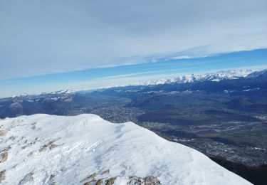
Snowshoes

Walking

Walking

Snowshoes
Walking
Walking
Walking