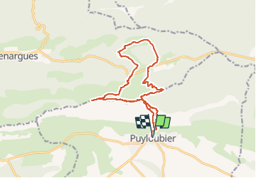
variante puyloubier

tosan
User

Length
15.7 km

Max alt
998 m

Uphill gradient
931 m
Km-Effort
28 km

Min alt
363 m

Downhill gradient
931 m
Boucle
Yes
Creation date :
2024-10-26 05:24:26.594
Updated on :
2024-10-26 05:24:28.235
6h23
Difficulty : Very difficult

FREE GPS app for hiking
 SityTrail
IGN / Geographical institutes
SityTrail Plus
The world is yours!
About
Trail Walking of 15.7 km to be discovered at Provence-Alpes-Côte d'Azur, Bouches-du-Rhône, Puyloubier. This trail is proposed by tosan.
Positioning
Country:
France
Region :
Provence-Alpes-Côte d'Azur
Department/Province :
Bouches-du-Rhône
Municipality :
Puyloubier
Location:
Unknown
Start:(Dec)
Start:(UTM)
716146 ; 4822713 (31T) N.
Comments