


T1

houbart
User
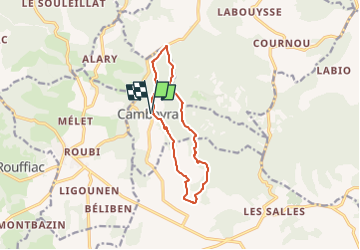

Length
10.8 km

Max alt
283 m

Uphill gradient
207 m
Km-Effort
13.6 km

Min alt
140 m

Downhill gradient
207 m
Boucle
Yes
Creation date :
2024-10-26 16:10:41.673
Updated on :
2024-10-26 16:12:28.161
3h05
Difficulty : Difficult

FREE GPS app for hiking
 SityTrail
IGN / Geographical institutes
SityTrail Plus
The world is yours!
About
Trail Walking of 10.8 km to be discovered at Occitania, Lot, Cambayrac. This trail is proposed by houbart.
Positioning
Country:
France
Region :
Occitania
Department/Province :
Lot
Municipality :
Cambayrac
Location:
Unknown
Start:(Dec)
Start:(UTM)
363477 ; 4920706 (31T) N.
Comments