


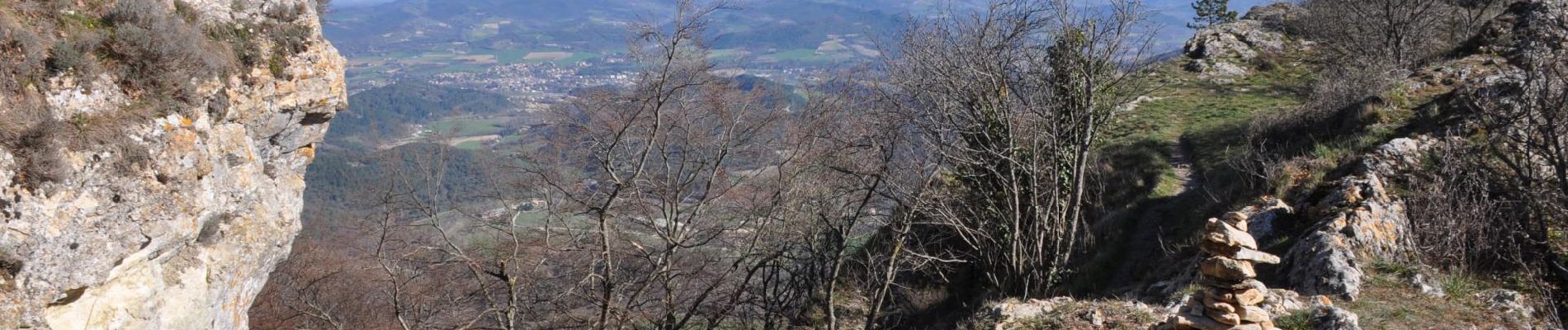
2024-10-27_08h45m28_Roche_Colombe_au_Pays_de_la_Foret_de_Saou

chancha
User GUIDE

Length
9.3 km

Max alt
874 m

Uphill gradient
583 m
Km-Effort
17.1 km

Min alt
332 m

Downhill gradient
584 m
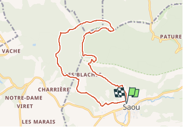
Boucle
Yes
Creation date :
2024-10-27 07:45:28.44
Updated on :
2024-12-19 16:59:34.752
3h53
Difficulty : Difficult

FREE GPS app for hiking
 SityTrail
IGN / Geographical institutes
SityTrail Plus
The world is yours!
About
Trail Walking of 9.3 km to be discovered at Auvergne-Rhône-Alpes, Drôme, Saou. This trail is proposed by chancha.
Photos


Positioning
Country:
France
Region :
Auvergne-Rhône-Alpes
Department/Province :
Drôme
Municipality :
Saou
Location:
Unknown
Start:(Dec)
Start:(UTM)
663440 ; 4945777 (31T) N.
Comments