


mbt27102024

Liebeaux
User
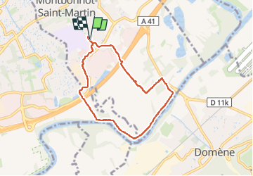

Length
6.9 km

Max alt
233 m

Uphill gradient
52 m
Km-Effort
7.6 km

Min alt
213 m

Downhill gradient
53 m
Boucle
Yes
Creation date :
2024-10-27 13:36:05.351
Updated on :
2024-10-27 15:29:39.367
1h53
Difficulty : Medium

FREE GPS app for hiking
 SityTrail
IGN / Geographical institutes
SityTrail Plus
The world is yours!
About
Trail Walking of 6.9 km to be discovered at Auvergne-Rhône-Alpes, Isère, Montbonnot-Saint-Martin. This trail is proposed by Liebeaux.
Positioning
Country:
France
Region :
Auvergne-Rhône-Alpes
Department/Province :
Isère
Municipality :
Montbonnot-Saint-Martin
Location:
Unknown
Start:(Dec)
Start:(UTM)
720512 ; 5011303 (31T) N.
Comments