


ratel2

Robert62
User
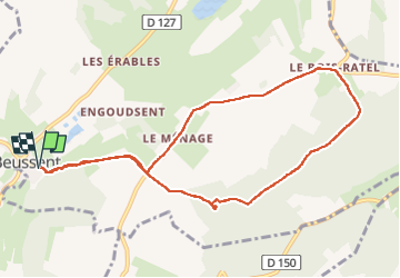

Length
8.9 km

Max alt
148 m

Uphill gradient
150 m
Km-Effort
10.9 km

Min alt
31 m

Downhill gradient
150 m
Boucle
Yes
Creation date :
2024-10-22 06:56:35.95
Updated on :
2024-10-28 16:14:07.456
2h30
Difficulty : Easy

FREE GPS app for hiking
 SityTrail
IGN / Geographical institutes
SityTrail Plus
The world is yours!
About
Trail Walking of 8.9 km to be discovered at Hauts-de-France, Pas-de-Calais, Beussent. This trail is proposed by Robert62.
Description
marche
Positioning
Country:
France
Region :
Hauts-de-France
Department/Province :
Pas-de-Calais
Municipality :
Beussent
Location:
Unknown
Start:(Dec)
Start:(UTM)
414631 ; 5600045 (31U) N.
Comments