


2024-10-28 Bouchier

guyverot
User
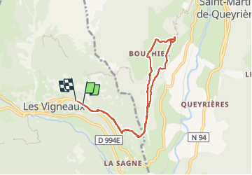

Length
8.5 km

Max alt
1515 m

Uphill gradient
459 m
Km-Effort
14.7 km

Min alt
1111 m

Downhill gradient
459 m
Boucle
Yes
Creation date :
2024-10-29 08:57:23.264
Updated on :
2024-10-29 14:01:33.553
2h54
Difficulty : Difficult

FREE GPS app for hiking
 SityTrail
IGN / Geographical institutes
SityTrail Plus
The world is yours!
About
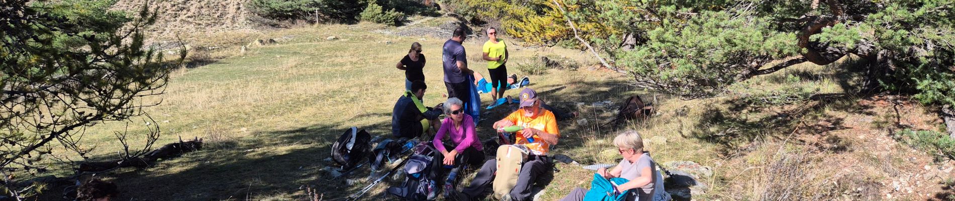
Trail Walking of 8.5 km to be discovered at Provence-Alpes-Côte d'Azur, Hautes-Alpes, Les Vigneaux. This trail is proposed by guyverot.
Photos


Positioning
Country:
France
Region :
Provence-Alpes-Côte d'Azur
Department/Province :
Hautes-Alpes
Municipality :
Les Vigneaux
Location:
Unknown
Start:(Dec)
Start:(UTM)
306242 ; 4966311 (32T) N.
Comments