


2024-10-30_18h55m00_Boucle_Samois_Denecourt_20241030

Franpey
User
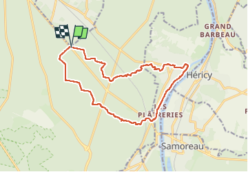

Length
16.1 km

Max alt
130 m

Uphill gradient
208 m
Km-Effort
18.9 km

Min alt
42 m

Downhill gradient
201 m
Boucle
Yes
Creation date :
2024-10-30 17:55:03.812
Updated on :
2024-10-30 17:55:08.617

FREE GPS app for hiking
 SityTrail
IGN / Geographical institutes
SityTrail Plus
The world is yours!
About
Trail of 16.1 km to be discovered at Ile-de-France, Seine-et-Marne, Fontainebleau. This trail is proposed by Franpey.
Positioning
Country:
France
Region :
Ile-de-France
Department/Province :
Seine-et-Marne
Municipality :
Fontainebleau
Location:
Unknown
Start:(Dec)
Start:(UTM)
477859 ; 5367270 (31U) N.
Comments