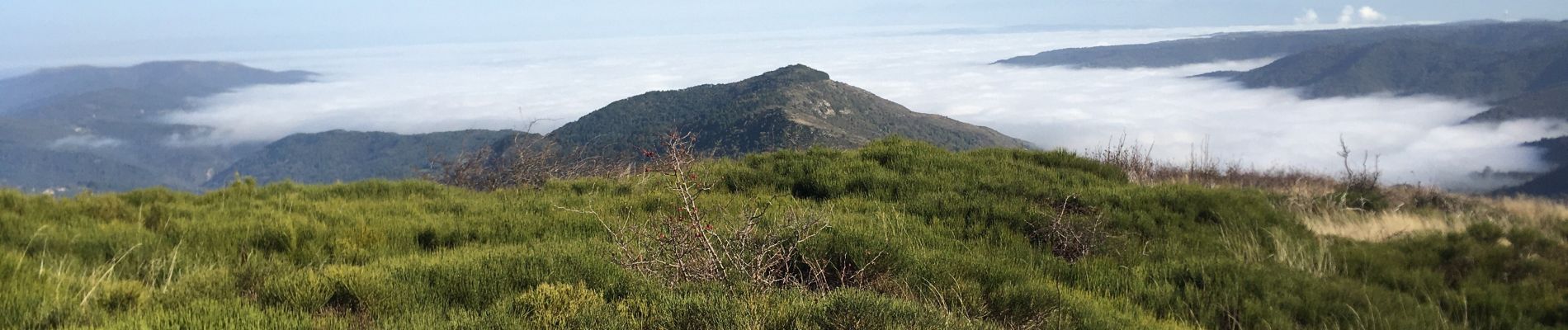
Trail Walking Gourdon - Roc de Gourdon  - Photo
 ajd26
ajd26

User

© OpenStreetMap contributors
Length
Length
17.7 km
Max alt
Max alt
1043 m
Uphill gradient
Uphill gradient
594 m
Km-Effort
Km-Effort  
26 km
Min alt
Min alt
591 m
Downhill gradient
Downhill gradient
594 m
Boucle
Boucle
Yes
Creation date :
2024-10-31 08:02:05.0
Updated on :
2024-11-01 09:26:21.395

(0 Reviews)

Walking
Walking
5h00
Difficulty : Medium

Scan this QR Code to open this trail in the SityTrail application

FREE GPS app for hiking

Logo SityTrail SityTrail

IGN / Geographical institutes

Download SityTrail from the App Store Download SityTrail from Google Play

Logo SityTrail SityTrail Plus

The world is yours!

Download SityTrail from the App Store Download SityTrail from Google Play Download SityTrail on Huawei AppGallery

About

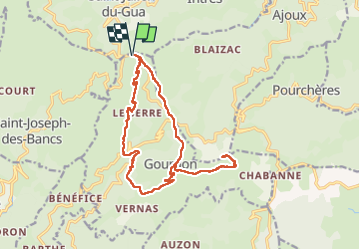
Trail Walking of 17.7 km to be discovered at Auvergne-Rhône-Alpes, Ardèche, Gourdon. This trail is proposed by ajd26.

Description

belle randonnée avec en prime l'ascension possible du roc de Gourdon, il n'y a plus qu'un fil électrique de clôture et une poignée est prévue pour passer
le première partie jusqu'au hameau de Rabachau est un peu délicate, il y a une trace bien visible mais par endroit ronces et genets obstruent le passage, il faut jouer du baton !!!
la suite est superbe et la trace pour monter au roc de Gourdon est très bien marquée
une vue à 360 récompense la montée
peu de goudron sur cette rando

Elevation profile

Photos

Positioning

Country:
France
Region :
Auvergne-Rhône-Alpes
Department/Province :
Ardèche
Municipality :
Gourdon
Location:
Unknown
Start:(UTM)
614477 ; 4956745 (31T) N.


Close
My subscriptions