


Études (groupe)

jacthiry
User
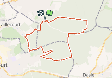

Length
10 km

Max alt
421 m

Uphill gradient
201 m
Km-Effort
12.7 km

Min alt
343 m

Downhill gradient
200 m
Boucle
Yes
Creation date :
2024-10-31 13:07:46.315
Updated on :
2024-10-31 16:07:18.396
2h58
Difficulty : Difficult

FREE GPS app for hiking
 SityTrail
IGN / Geographical institutes
SityTrail Plus
The world is yours!
About
Trail Walking of 10 km to be discovered at Bourgogne-Franche-Comté, Doubs, Étupes. This trail is proposed by jacthiry.
Positioning
Country:
France
Region :
Bourgogne-Franche-Comté
Department/Province :
Doubs
Municipality :
Étupes
Location:
Unknown
Start:(Dec)
Start:(UTM)
339557 ; 5262785 (32T) N.
Comments