


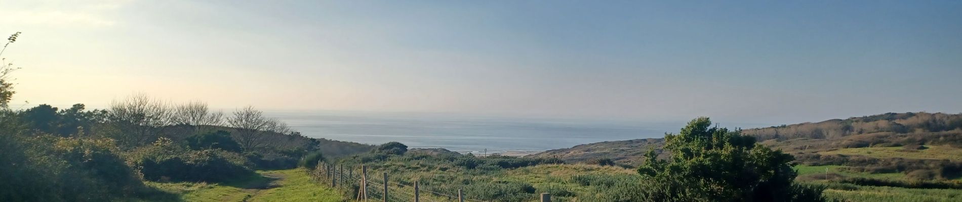
Condette 31 Octobre 2024

tenace
User
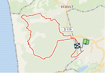

Length
10.3 km

Max alt
89 m

Uphill gradient
144 m
Km-Effort
12.3 km

Min alt
29 m

Downhill gradient
150 m
Boucle
Yes
Creation date :
2024-10-31 13:18:31.274
Updated on :
2024-10-31 16:34:40.678
3h15
Difficulty : Difficult

FREE GPS app for hiking
 SityTrail
IGN / Geographical institutes
SityTrail Plus
The world is yours!
About
Trail Walking of 10.3 km to be discovered at Hauts-de-France, Pas-de-Calais, Condette. This trail is proposed by tenace.
Photos


Positioning
Country:
France
Region :
Hauts-de-France
Department/Province :
Pas-de-Calais
Municipality :
Condette
Location:
Unknown
Start:(Dec)
Start:(UTM)
401978 ; 5611949 (31U) N.
Comments