


Lac Matane Claret

Roger Philippe Wallez
User GUIDE
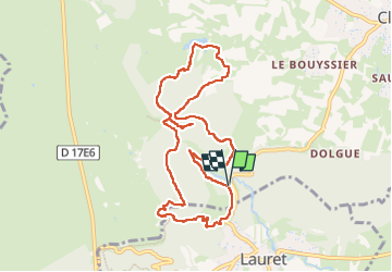

Length
10.4 km

Max alt
398 m

Uphill gradient
370 m
Km-Effort
15.3 km

Min alt
184 m

Downhill gradient
372 m
Boucle
Yes
Creation date :
2024-11-02 09:29:07.0
Updated on :
2024-11-02 14:41:48.435
5h11
Difficulty : Difficult

FREE GPS app for hiking
 SityTrail
IGN / Geographical institutes
SityTrail Plus
The world is yours!
About
Trail Walking of 10.4 km to be discovered at Occitania, Hérault, Claret. This trail is proposed by Roger Philippe Wallez.
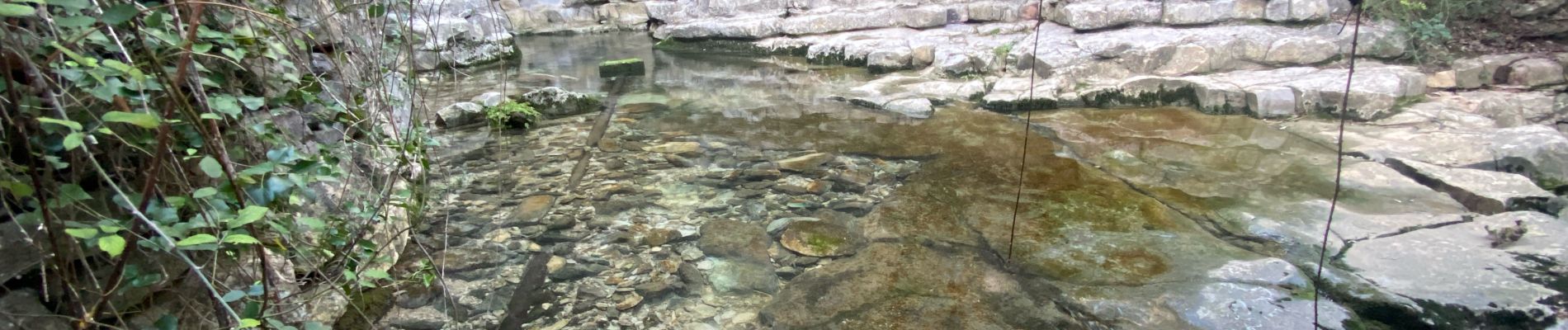
Photos


Positioning
Country:
France
Region :
Occitania
Department/Province :
Hérault
Municipality :
Claret
Location:
Unknown
Start:(Dec)
Start:(UTM)
570663 ; 4854811 (31T) N.
Comments