


Mont Fourcat le 2.11.24

chrisgps
User
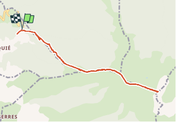

Length
10.2 km

Max alt
1999 m

Uphill gradient
815 m
Km-Effort
21 km

Min alt
1182 m

Downhill gradient
818 m
Boucle
Yes
Creation date :
2024-11-02 08:40:00.171
Updated on :
2024-11-30 16:23:26.74
6h07
Difficulty : Easy

FREE GPS app for hiking
 SityTrail
IGN / Geographical institutes
SityTrail Plus
The world is yours!
About
Trail Walking of 10.2 km to be discovered at Occitania, Ariège, Mercus-Garrabet. This trail is proposed by chrisgps.
Photos


Positioning
Country:
France
Region :
Occitania
Department/Province :
Ariège
Municipality :
Mercus-Garrabet
Location:
Unknown
Start:(Dec)
Start:(UTM)
391293 ; 4747465 (31T) N.
Comments