Essai plaine 25k

ophness
User
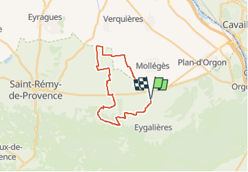

Length
24 km

Max alt
133 m

Uphill gradient
169 m
Km-Effort
26 km

Min alt
43 m

Downhill gradient
170 m
Boucle
Yes
Creation date :
2024-11-02 18:05:53.0
Updated on :
2024-11-02 18:05:54.93

FREE GPS app for hiking
 SityTrail
IGN / Geographical institutes
SityTrail Plus
The world is yours!
About
Trail of 24 km to be discovered at Provence-Alpes-Côte d'Azur, Bouches-du-Rhône, Eygalières. This trail is proposed by ophness.
Positioning
Country:
France
Region :
Provence-Alpes-Côte d'Azur
Department/Province :
Bouches-du-Rhône
Municipality :
Eygalières
Location:
Unknown
Start:(Dec)
Start:(UTM)
656680 ; 4849441 (31T) N.
Comments