


Consdorf 8km

Damien1271
User
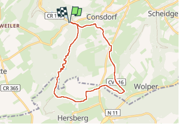

Length
7.7 km

Max alt
395 m

Uphill gradient
149 m
Km-Effort
9.7 km

Min alt
295 m

Downhill gradient
152 m
Boucle
Yes
Creation date :
2024-11-03 09:18:57.577
Updated on :
2024-11-03 11:41:41.627
2h22
Difficulty : Medium

FREE GPS app for hiking
 SityTrail
IGN / Geographical institutes
SityTrail Plus
The world is yours!
About
Trail Walking of 7.7 km to be discovered at Unknown, Canton Echternach, Consdorf. This trail is proposed by Damien1271.
Positioning
Country:
Luxembourg
Region :
Unknown
Department/Province :
Canton Echternach
Municipality :
Consdorf
Location:
Unknown
Start:(Dec)
Start:(UTM)
307582 ; 5517440 (32U) N.
Comments