


trail des roches à poncin

bubufred
User
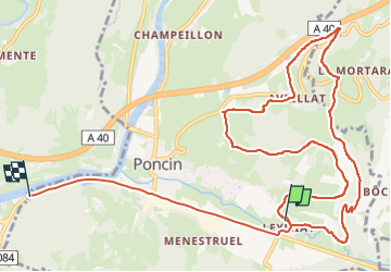

Length
13.6 km

Max alt
435 m

Uphill gradient
323 m
Km-Effort
18 km

Min alt
255 m

Downhill gradient
327 m
Boucle
No
Creation date :
2024-11-03 09:57:11.965
Updated on :
2024-11-03 11:45:52.492
1h18
Difficulty : Very easy

FREE GPS app for hiking
 SityTrail
IGN / Geographical institutes
SityTrail Plus
The world is yours!
About
Trail Trail of 13.6 km to be discovered at Auvergne-Rhône-Alpes, Ain, Poncin. This trail is proposed by bubufred.
Positioning
Country:
France
Region :
Auvergne-Rhône-Alpes
Department/Province :
Ain
Municipality :
Poncin
Location:
Unknown
Start:(Dec)
Start:(UTM)
687700 ; 5105801 (31T) N.
Comments