


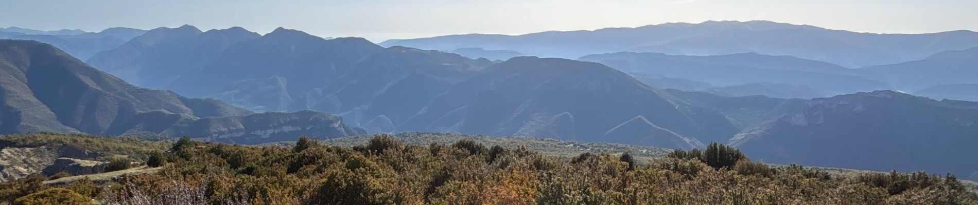
Mont Mairola (Mayola)

GeorgesV.
User
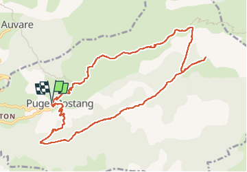

Length
12.4 km

Max alt
1581 m

Uphill gradient
883 m
Km-Effort
24 km

Min alt
702 m

Downhill gradient
887 m
Boucle
Yes
Creation date :
2024-11-03 07:38:53.0
Updated on :
2024-11-03 14:24:22.146

FREE GPS app for hiking
 SityTrail
IGN / Geographical institutes
SityTrail Plus
The world is yours!
About
Trail of 12.4 km to be discovered at Provence-Alpes-Côte d'Azur, Maritime Alps, Puget-Rostang. This trail is proposed by GeorgesV..
Photos
 - Photo 1")
 - Photo 2")
 - Photo 3")
 - Photo 4")
 - Photo 5")
 - Photo 6")
Positioning
Country:
France
Region :
Provence-Alpes-Côte d'Azur
Department/Province :
Maritime Alps
Municipality :
Puget-Rostang
Location:
Unknown
Start:(Dec)
Start:(UTM)
332955 ; 4871108 (32T) N.
Comments