


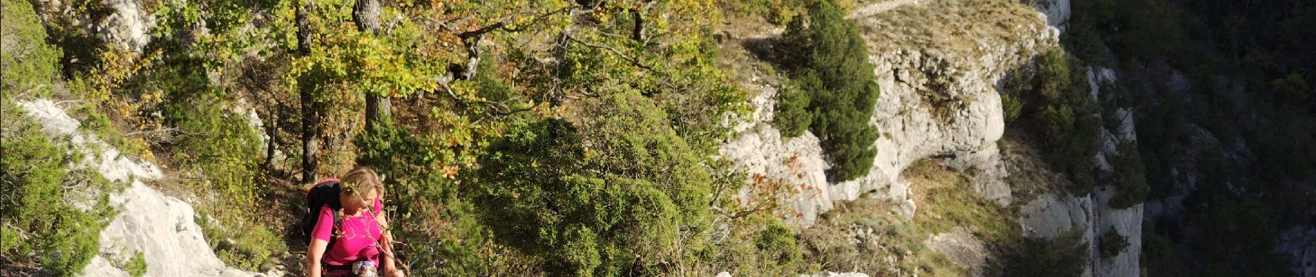
Gorges de la Nesque

cousam
User
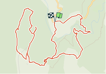

Length
10.3 km

Max alt
849 m

Uphill gradient
469 m
Km-Effort
16.5 km

Min alt
597 m

Downhill gradient
467 m
Boucle
Yes
Creation date :
2024-11-03 10:08:30.35
Updated on :
2024-11-04 07:59:07.748
4h36
Difficulty : Difficult

FREE GPS app for hiking
 SityTrail
IGN / Geographical institutes
SityTrail Plus
The world is yours!
About
Trail Walking of 10.3 km to be discovered at Provence-Alpes-Côte d'Azur, Vaucluse, Monieux. This trail is proposed by cousam.
Description
Avec le rocher de Cire
Photos


Positioning
Country:
France
Region :
Provence-Alpes-Côte d'Azur
Department/Province :
Vaucluse
Municipality :
Monieux
Location:
Unknown
Start:(Dec)
Start:(UTM)
686857 ; 4879640 (31T) N.
Comments