


le coin de Manon

Georges Montanelli
User
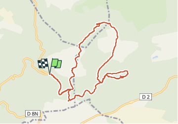

Length
12.2 km

Max alt
511 m

Uphill gradient
272 m
Km-Effort
15.8 km

Min alt
365 m

Downhill gradient
272 m
Boucle
Yes
Creation date :
2024-11-05 08:38:07.621
Updated on :
2024-11-05 15:43:30.794
4h09
Difficulty : Difficult

FREE GPS app for hiking
 SityTrail
IGN / Geographical institutes
SityTrail Plus
The world is yours!
About
Trail Walking of 12.2 km to be discovered at Provence-Alpes-Côte d'Azur, Bouches-du-Rhône, Cuges-les-Pins. This trail is proposed by Georges Montanelli.
Description
rando pedestre
Positioning
Country:
France
Region :
Provence-Alpes-Côte d'Azur
Department/Province :
Bouches-du-Rhône
Municipality :
Cuges-les-Pins
Location:
Unknown
Start:(Dec)
Start:(UTM)
723328 ; 4795085 (31T) N.
Comments